Saturday, February 28, 2015

Lake Barkley Kentucky


Canoeing Lake Barkley

 Lake Barkley

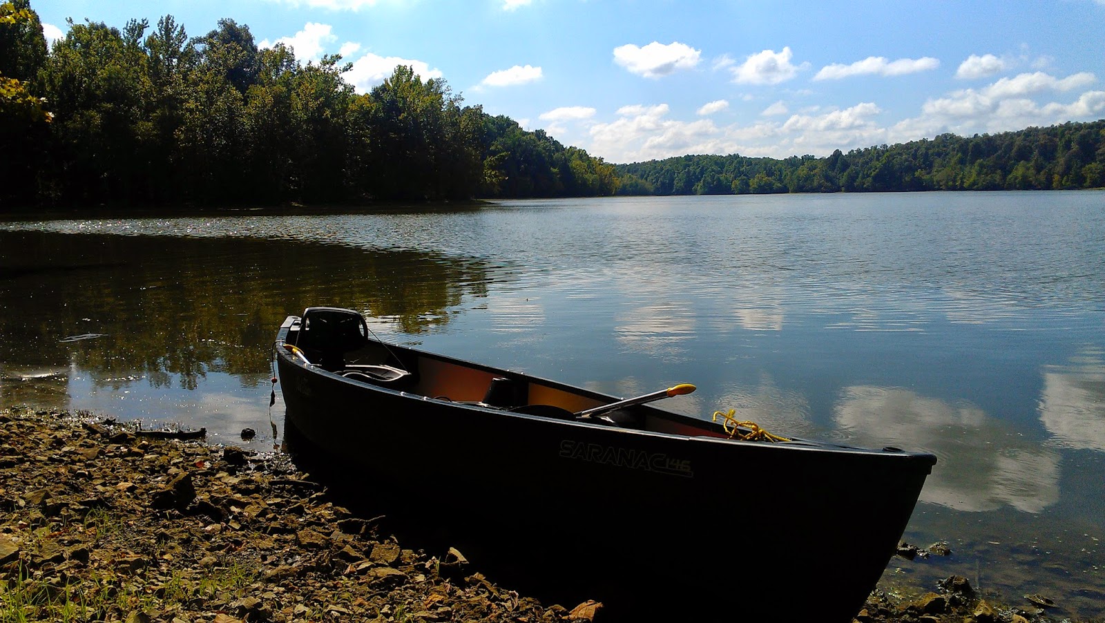
On a recent trip to my Aunt's in the Blue Ridge Mountains of North Carolina my husband and I went paddling down the French Broad River. We were hooked! Once home we immediately purchased a canoe, Old Town Sarnac XL and began our canoeing adventures. 

Blue skies over Barkley

For our first outing we chose a quite bay on Lake Barkley not to far from home. Now when we paddled the French Broad we used a John Boat while my Uncle and Step-Dad were in a canoe. I was prepared for the unsteadiness, my husband however was not. I got in first, my husband pushed the canoe out a bit further, and made his entry. Only he didn't sit down immediately and began commenting about how tipsy it was. We were less than three feet from shore and I was about to be dumped into two feet of water with a muddy bottom. I promptly threatened him (Ha!) and told him to sit down, which thankfully, he did. The remainder of the trip was very enjoyable and I knew I had found my new addiction. 

Paddling the bay 

One of the great things about living in Kentucky is it has the second most navigatable waterways in the nation, Alaska comes in first. Kentucky Lake and Lake Barkley combine for over 3,300 mikes of shoreline, more than Lake Michigan. Kentucky Lake is actually the largest artificial lake east of the Mississippi River. There are plenty of bays to paddle and feeder creeks that drain into them. There is barge traffic and recreational boat traffic of all types, on both lakes so expect wakes. Staying in the bays lessens wakes from barges but recreational boats explore quite deeply into the bays during Summer pool. These lakes were formed by the daming of the Tennessee River and the Cumberland Rivers, respectively and are major transportation routes to the Ohio and Mississippi Rivers. When the rivers flooded, creating the lakes, Land Between the Lakes was also formed. There is a sad and tragic side to the creation of the lakes, but I think an article by David Nickell tells it best, Land Between the Lakes: A Story of Colonialism in Kentucky.

Girls Canoe Day
 We spent many days marveling at the beauty, the wildlife, and the peace and quiet that surrounded us.  I couldn't count the number of deer we seen from the canoe, just yards away on the bank in the forest. I can tell you of the family of otters that we saw one morning. Playing along the shoreline and skillfully dodging us as we paddled near. Fishing from the canoe was amazing and we caught several kinds, large mouth bass, bluegill, and catfish. Watch out for the intrusive Asian carp, they tend to jump out of the water when frightened by motors so a nearby passing boat could stir the huge fish up.

Bridge in back of one of the many bays
It's quite easy finding a place to put your canoe or kayak in, public boat ramps, use areas, and campgrounds abound in Land Between the Lakes. Back country camping is allowed with permit and in almost any location aside from cemeteries of course. There are many roads that were flooded also and lead directly into the water, follow almost any road long enough and you'll find a bay to explore. There are also several small lakes contained in Land Between the Lakes, such as Energy Lake, Hematite and Honker Lakes. Recently the latter two have been unnavigable due to Lily Pads and invasive species.

I can't wait until Spring so we can get the Sarnac back out and explore more of Lake Barkley! I'm especially excited to explore a channel of the Cumberland River named for distant ancestors who once lived in the area.


Happy Paddling!!


Garden of the Gods - Shawnee National Forest

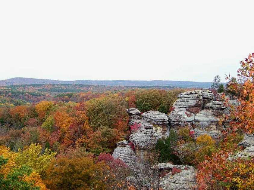
Fall Scene from Sandstone bluff 
 I've already covered this area in a previous blog but had numerous photos just to beautiful not to share. Sit back and enjoy the view! 


Fall at Garden of the Gods 

Obersvation deck

Camel Rock

Sandstone Bluffs

Sandstone Bluffs 
Scene from the trail


Links:


Rim Rock - Shawnee National Forest


Ox Lot Cave

Rim Rock

The Shawnee National Forest never ceases to amaze. This marvelous wonder of nature sits near Herod, IL. Just a few miles drive on Karber's Ridge Rd. down from Garden of the Gods awaits Rim Rock National Recreational Trail

The trail starts from the parking area, makes it way along a ridge with several scenic views, and comes to a landing for more vistas. This section of the trail is fairly easy to traverse and has a few benches to rest upon. Beyond this point it becomes a bit more strenuous. Wooden stairs lead down to narrow passages between towering rocks of sandstone covered in moss. 

Narrow passage with stone steps
Descending into Rim Rock
Boulders near landing

As you exit the passages that take you down to the forest floor you are presented a view that will take your breath away. Sandstone bluffs rise on both sides, a small creek meanders next to the far bluff, the forest is alive with birds chirping and squirrels scury about. Coming into view is Ox Lot Cave, used originally by Native Americans and later by settlers to shelter livestock, including oxen and horses used by loggers.

The trail continues past Ox Lot Cave and follows Rim Rock along the forest floor, providing stunning views all around. 

Fall Scene of Rim Rock from trail
Green moss makes amazing backdrop for Fall colors
View of Sandstone bluff opposite of Rim Rock

Continue on Rim Rock Trail and you come to an intersection. Straight over a small wooden foot bridge takes you along the Beaver Trail to Pounds Hollow where you'll find a very nice pay use camping area, lake with beach, and picnic areas. I camped there with family a few Summers ago and swam at the beach as a child which was pay use then and also rented paddle boats. The beach is now free but with no lifeguard on duty, swim at your own risk. There are limits for boating on the lake making for a more enjoyable experience all around. The area is patrolled by rangers and police regularly to enforce rules and laws which keeps the partying to a minimum and keeping it the family friendly outdoor experience everyone can enjoy.

View between Sandstone bluff and Rim Rock Trail

Rim Rock Trail near Beaver Trail intersection

Staying on trail, go right which keeps Rim Rock itself on your right. The trail continues through the canyon to a larger wooden foot bridge over a rocky creek bed. 

Wooden foot bridge
The trail passes over this bridge and continues back toward the parking area, sloping uphill. Several more smaller foot bridges dot the trail back up and out of the canyon. 

I've hiked this trail more times than I can remember and have numerous tales that I couldn't begin to fit in one blog. I will give you the highlights; Female cousin running near trail head, tripped, fell, and tumbled several yards downhill. Further down trail and this could have been very disastrous.
Another one of "good ol' Dad's" Army Mission hikes where it's either keep up or be left behind, we were always left behind. Only this time dark was approaching adding an extra bit of fear. Young, alone, and hiking the Shawnee in the pitch black. Clearly I survived but my city cousins and God-Sister may have been traumatized. Just kidding! 
 Hikes with our first family dog, pulling us through the forest at a record pace. To one of our last hikes with our friend and his young daughter who when told about the Native Americans in Ox Lot Cave insistied we all have Indian names. 

I strongly suggest planning an extended weekend stay camping at Pounds Hollow or booking a stay with Rim Rock's Dogwood Cabins, or for a even more unique stay check out Timber Ridge Outpost and sleep in a treehouse nestled in the forest canopy of the Shawnee Hills near Elizabethtown, IL. I will also advise don't expect to see all The Shawnee National Forest has to offer in one trip. I been exploring the area for years and still haven't seen it all or even come close to it. 


Happy Hiking! 


Cache River

Cache River, Section 8 Woods

Another gem of The Shawnee National Forest is the Cache River State Natural Area  near Cypress, IL. Bottom land created by glacial runoff created this ancient blackwater swamp. 

Old growth Cypress trees dot the swamp and provide refuge for an array of birds from Eagles, hawks, osprey, and woodpeckers just to name a few. There is a Wetland Center providing an educational experience the whole family can enjoy.


Cache River Wetland

There are several areas within this network of wetlands, Heron Pond near Belknap, IL in the  Little Black Slough Unit provides a boardwalk to explore the swamp and walk amongst the Cypress and Tupelo trees. 

The Lower Cache River Swamps between Karnak and Ullin, IL provides a paddle trail for canoers and kayakers to explore the swamp. Paddle past wildlife, enjoy a bit of birding, and be awe struck by the old growth Cypress trees. 

Section 8 Woods Boardwalk

Glass Hill Management Unit located just north of Cypress, IL boasts a high sandstone knob that is inaccessible and therefore has a realitivly undisturbed upland forest. 

There are 9 different hiking trails as well as a bike trail,  the aforementioned canoe trail and Wetlands Center. Events are hosted year round and include van tours to wildflower hikes.

View from boardwalk

Southern Illinois has some of the most diverse topography and wildlife in the country. You're sure to find a place you can enjoy or in my case many places! 

Happy Hiking! 


Friday, February 27, 2015

Ferne Clyffe State Park - Shawnee National Forest

Ferns grow from a cliff face

Ferne Clyffe State Park is nestled in the Shawnee Hills and just south of Goreville, IL off Route 37. Privately owned until 1949 when it was sold to the state, people have been enjoying the area long before then. Since as early as 1899 Ferne Clyffe has been an attraction for many. 

Eighteen different trails in varying length and difficulty provide an adventure for just about anyone. Horses are allowed on designated trails, there is camping, a lake for fishing, a seasonal waterfall and even areas for rock climbing and rappelling. 

Scene along Big Rocky Hollow Trail 

I have to say I wasn't aware of all the trails located here until I started this blog. I've hiked the area for years but only stuck to two main trails, the Big Rocky Hollow and High Ridge Trails. Further exploration is needed. 

Tree dividing the trail

The trails that stay below the ridge and falls are the least strenuous. The High Ridge Trail is more rugged and has a steep climb, any trail here is well worth the effort. The lower trails tend to be cooler in the Summer months providing an oasis from the heat and humidity.

Waterfall when dry from base

Picnic shelters and playgrounds abound in this family friendly park. Camping areas vary from modern, to primitive, and back country, offering something for everyone. Trails vary from .25 miles to 8 miles of the River to River Trail. There are even more trials on the adjoining Round Bluff Nature Preserve. 

Large boulder along trail

The beauty and wonder of the Shawnee has given yet another awe inspiring place. 


Happy Hiking!!!!


Forgotten Treasure, Teal Pond - Shawnee National Forest

Teal Pond


Teal Pond 

Just North of Bell Smith Springs off the winding gravel road that cuts through The Shawnee National Forest you'll find Teal Pond and a forgotten campground. Over grown, unkept, and being reclaimed by the forest this campground was once a well maintained pay use area. I can only assume, probably correctly, that budget cuts forced it's closure long ago. It was a shame to see in it's current state but nostalgia and Mother Nature made it easy to still find the beauty. 


Teal Pond 

As I've said in my previous blogs I spent a lot of time outdoors since I was a child and in S. IL that meant time in the National Forest, at least to us anyway. As dysfunctional as my family could be, isn't everyone's to some degree, this love for the outdoors that they taught me is the best lesson. I consider it a gift from my parents, the gift of a lifetime. One that is continually giving, amazing, and awe inspiring. 

The road through the campground

Somehow it had been decided we would go camping at this little hidden spot, away from the mainstream. My parents packed and loaded our gear and supplies into our old 70's model Vista Cruiser Station Wagon, with us two kids, and headed off for a extended weekend adventure. My brother and I were about 9 and 11 years old, respectively, and very excited about the trip. 

There weren't many others at the campground which we delighted in. More seclusion meant a better outdoor experience to us. Looking back there may have been a few reasons for the sparse occupancy of the campground. 

Bridge from campground to Teal Pond

The  first night my mom thought it would be funny to scare us kids and threw some chicken bones behind the little pup tent that my brother and I shared. She told us stories of mountain lions and bobcats around the fire, much like telling ghost stories. We didn't think much of moms tales till the next morning when we discovered our camp had been raided. Our food laid half eaten and strewn across the campsite. There were eggs busted, half eaten loaf of bread, and even the ketchup bottle had been chewed. The contents of our food stash was almost no more but for a few can goods and items from the bottom of the cooler. We also found paw prints behind our pup tent, big paw prints, from a large cat. Obviously we hadn't secured things very well and we had visitors in the form of raccoons and a bobcat. We could only assume the bobcat had scared off the raccoons midfeast and that had saved some of the food for us. I don't know why the bobcat then didn't eat what remained, maybe he too was scared off by someone stirring in their sleep. 

Not being ones to give up or scared by wildlife easy we decided to tough it out and then the rain came. Struggling to make fire, stay dry and stab open cans with a survival knife because Mom forgot the can opener we made it through the day. I think I remember my brother getting the cans open and catching a fish or two from the pond for supper while Dad fought to get and keep a fire going. 

 The rain continued into the night and must've gotten heavier at some point because the next thing I remember was Mom waking us up in the middle of the night. We were sleeping in almost 2" of water, our own pool in the pup tent. She rushed us over to the Vista Cruiser and we slept in the back storage area with the back seats folded down for more room. My parents shared the front seat, we spent the night sleeping and drying out once the thunder and lighting subsided. 

Dogwood in campground area

The next day we decided again to stay and tough it out and I do mean we, as a family we voted. Making a fire was nearly impossible, and we were all now resigned to camp in the Station Wagon or share the very large tent my parents used. We hung our things up to dry as best we could, and as I began changing in my parents tent when a leak started directly over my head in a corner. I proceeded to have a little meltdown, at 9 years old I had apparently reached my limit with my patience for Mother Nature. My family found it amusing, and I see now that they were only laughing because what good was crying going to do? The concept took me a few years to figure out growing up but it's now second nature to me. 

Levy wall next to Teal Pond

We spent one more night, all under the canopy of my parents tent, and away from the leaky corner. Thankfully it was an uneventful night, we packed up the next day and headed home without incident. It would have been easy to quit and come home after our food was raided, but we weren't ready to give up and I'm glad we didn't despite the set backs. What kind of memory and story would that had made? Toughing it out against the odds and finding away to make things worked is how we lived, not just how we camped. Smile in the face of adversity and if nothing else you'll have an amazing memory to recall. This is another fond memory for my family and I, we now recall it and laugh till we cry sometimes.

If you venture over to Bell Smith Springs take the time to stop at Teal Pond, cast a line, take a stroll, have a picnic as we did, or you can still camp even, just back country style now. I recommend securing your food though and leave no bones behind the tent! 

Happy Camping and Hiking!!! 


Thursday, February 26, 2015

The Shawnee National Forest-Bell Smith Springs

Devil's Backbone 

Bell Smith Springs


The Shawnee National Forest  yet again provides us with another wonder of Mother Nature's beauty and power. Nestled in the Hidden Springs Ranger District this area is a National Natural Land Mark, as it should be. The topography of Southern Illinois and its trademark sandstone bluffs, hoodoos, gluches, and canyons afforded us another awe inspiring spot. 

Located just East of Eddyville, IL off Highway 145 and down winding back roads sits Bell Smith Springs. Hidden away from the hustle and bustle of, well..pretty much everything. Eddyville is a tiny town that only had a poplutaion of 98 citizens in 2013, so even the closest populace isn't much for hustle and bustle. 


Main stairs to trails


Bell Smith Springs has 8 Miles of trails over rugged, and sometimes strenuous terrian. Several creeks meander through, over, and around the sandstone rocks. This does cause them to be very slippery and washes out some of the trails on occasion, as was on my visit last Spring. I suggest keeping a trail map handy to stay on course. General area trails total 1.5 miles, the Natural Bridge Trail and Sentry Bluff trail are the most rugged of those I've hiked, which only excludes the Mill Branch Trail. 

View a long General Area Trail


Sentry Bluff Trail earns its name from the bluff the trail skirts along. Rocks, roots, and other obstacles make for unsure footing and a rough hike but is well worth the 3.2 miles around the bluff. 

General Area & Natural Bridge Trail


The Natural Bridge Trail requires a stream crossing that can be tricky during higher water levels. After crossing the stream, some ways up the trail, you must climb a type iron ladder secured into the sandstone, to access the Natural Bridge and remaining trail. 

The last time I attempted this hike I was 17 years old with my slightly older cousin and her boyfriend, now husband. We were led by my father who always seemed to be on an Army Mission, leading his troops at a blistering pace. Keep up or be left behind, and we were on several occasions, including this one. The creek was swollen making the crossing tricky and after nearly falling a few times I made it across. Now thoughly wet from mid thigh down, we trek onward till we come to the "ladder". No sign of good ol dad, guess he climbed the ladder, and so wet feet and all we climbed up. 

We found ourselves at the Natural Arch, so we messed around for a bit exploring and drying out. No idea where "dad" is, either way ahead on the trail or eaten by a wild animal. Not wasting any more time we hiked the remainder of the trail, which I don't remember much of. I figure either stress or trauma erased it from my mind. Dad was found resting and hydrating at the trailhead. 

Sandstone bluff and view from Sentry Bluff trail, looking toward Natural Bridge Trail. 

The Spring of 2014 I finally returned to Bell Smith Springs after nearly 20 years absence. The wonder and beauty of the place hadn't changed. The trails felt a not as long as I remembered and the stairs less daunting than before.  The terrain was as rugged as ever though, but I guess that's what gives it it's beauty. Time may have gotten away from me, enjoying my youth and starting my own life as an adult, but it hasn't gotten away from in my middle age. Now more than ever appreciate nature and seek it's refuge often. 

No, the experience I had as a teen didn't leave my in fear of nature or with any distaste for it. Nature was and is my second home. You just have to accept nature, and people, as they are and just deal with it. The thing is, I've learned to still have fun along the way and this story is a fond memory for me. 

Happy Hiking! 


Wednesday, February 25, 2015

Save the Bayou!

Turkey Bayou


Besides Land Between the Lakes needing help with protection from the US Forestry Service there's another place needing assistance. Turkey Bayou, my previous blog subject, in The Shawnee National Forest. Friends of the Bayou won their battle with the USFS and Turkey Bayou remains open. The question is for how long? One of the stipulations to keeping Turkey Bayou open was that Friends of the Bayou had to maintain it, not only with labor but with money. The campground must be kept clean of trash and debris, it must be mowed a certain number of times per year, facilities must be kept in good condition, i.e. picnic tables, fire rings, roads and the camp sites in general. Years have passed and Friends of the Bayou have delved into their own pockets to keep the place they love open. Now those pockets are becoming empty and if Friends of the Bayou can't raise the funds Turkey Bayou will close. There is no charge to pitch a tent or park an RV at Turkey Bayou, it was kept open for all to enjoy, free of charge, as our public lands should be. If we can all reach into our hearts, remember the love you have for your favorite spot outdoors, and pitch in a few bucks to assist those who know that love as well.

Donate Here

And as always, Happy Hiking!

Tuesday, February 24, 2015

Do You Bayou? Turkey Bayou - Shawnee National Forest

Turkey Bayou


Another beautiful place brought to you by The Shawnee National Forest and Friends of the Bayou. Hidden beneath the bluffs that overlook the Mississippi River in Southern Illinois this free campground, yes free, is totally maintained by donations and the graciousness of it's savior.  

Turkey Bayou was slated for closure by the US Forestry Service, a group of passionate people and some help from a politician who actually cared, Turkey Bayou was saved. Friends of the Bayou is now contracted by the US Forestry Service for the upkeep and maintenance of the site. Donations are critical to the upkeep of this free campground, for years it was paid for privately but that well is running dry. 

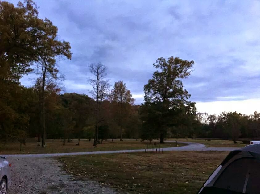
Turkey Bayou Campground

Turkey Bayou Campground


Located off Route 3 just North of Grand Tower, IL and behind Oakwood Bottoms Greentree Reservoir, Turkey Bayou sits under the bluffs and in a bend of the Big Muddy River. Check in at the entrance, obey all laws and regulations posted. We do not need to jepordize the contract afforded to Friends of the Bayou. 


Fog rises off the Bayou

The campground is primitive, no potable water and no facilities. Back country camping with flare would describe it best. The site is well maintained, free of trash and downed limbs. Gravel sites surrounded by grass, fire rings provided, picnic tables, and keep to the shaded spots in warmer months. There are several open spots closer to the bayou edge and these are nice spots for Fall or early Spring but the Sun will be to much any other time of year. Mosiquito spray is strongly advised in warmer months and any other bug repellent. Yes, you will find snakes, it is a bayou, be aware and alert. We camped in the Fall and did not have problems with bugs or snakes, all though it was a cold night for a tent once or twice. There are also some trails from the back sites to the Big Muddy, they are narrow but a kayak or canoe portage is doable. A boat ramp is located just a short walk or drive down the only gravel road in/out. 

I was very pleased with the campground not being one who requires a privy and if can manage to wash up, I'm good to go...for a couple days at least anyway. We had an adventure regarding air mattresses and sleeping arrangements. My mother bought a new mattress that was to large for their use, so we traded. The trade was good till Mom's, my old one, sprung a leak and my parents spent the rest of the trip sleeping in the cab of the truck. Yes, I offered them our tent but a handicap would have made it near impossible for Mom to get up and out of the tent. There are a lot of nights she sleeps in a recliner. It worked, they had heat and stayed fairly comfortable. There's always some hiccup once you're out in the middle of no where but you just have to roll with it and make the best of things. I will say again how cold it was a few nights, upper 30's, but plenty of blankets and layers, it wasn't an issue. The dew was very heavy every morning we were there and the Fall Sun fed winds that thankfully died with the daylight. 

While you're at Turkey Bayou you absolutely must take a drive down Pine Hills Rd, again off Route 3, and you can pick up the start of the road at Wolf Lake, IL or pick it up just South of Grand Tower, IL. This scenic drive will take your breath away. 

View from Pine Hills Rd. 


The bluff from Big Muddy Levy Rd. 

The area is also known for it's ties to Lewis & Clark who passed through with the Corps of Discovery on their way West to the Pacific Ocean. Trail of Tears State Forest is nearby in Jonesboro, IL, it offers plenty of hiking trails over very rugged terrian and all the amenities of a State Park and let's not forget the tragic history of its name. You will also find the Little Grand Canyon to the North and the Pomona Natural Bridge just East of that. Further North lies Johnson Creek Recreation Area with more camping, lake and boat ramp. Turkey Bayou is a central location for your exploration in the Mississippi Bluffs Ranger District and a treasure we shouldn't loose for lack of funding. 

Hope you get to go enjoy Turkey Bayou and all The Shawnee National Forest has to offer! 

Happy Hiking!!!