Wednesday, August 19, 2020

Jack's Fork Adventure

      Paddling the shallow waters of the Buffalo River in Arkansas late last Summer with some gal pals we decided it should be an annual thing for us. Every year we are going to randomly choose a place, a date, and go!! 
    This year has been an insane year for everyone so the trip was needed more than ever. I selected Jack's Fork River in the Missouri Ozarks and part of the Ozark National Scenic Riverways. I had heard that it was much less of a party scene than the Current River which was nearby. 
    Our Girl's trips are only conventional in the sense that it's only females but after that is when conventional definitely takes a serious nose dive. We kayak, camp, get dirty, sunburned, maybe a little dinged, dented but we wouldn't have it any other way and we love every minute of it. The party scene was not our scene, nor are slumber party sleep overs, nor spa days, so to Jack's Fork we go. 
   I did research which included calling a outfitter several times to communicate our intent, gather Intel on river conditions, trip information, etc. Maps were ordered in advance from the National Park Service, websites study, weather forecasts, river levels and precipitation monitored. I even viewed the entire trip on the river via Google Satellite and watched YouTube videos.
  We wanted an overnight paddling trip, but the outfitter wouldn't go any further up than Alley Springs due to typical low water levels this time of year (Mid August), so we had to put in at Alley. We could float to the end of Jack's Fork River and take out at Two Rivers, the confluence of the Jack's Fork and Current Rivers. 
  The outfitter site listed this as 15 miles and stated it was more of a day trip rather than an overnight. Six to eight hours I was advised to make the entire 15 miles but knowing how we like to goof off, stop for breaks to swim, eat, explore, etc. I figured we could make it an easy overnight trip with plenty of time for shenanigans. 
  National Park Service map lists the trip as just 13.6 miles....well that's confusing but I figured 1.4 miles wouldn't make that much of a difference if the outfitters site was correct vs. the NPS. 
  The plan was to find somewhere to make camp at the 7-9 mile mark, 4 hours roughly from what I was advised, which I would track using an app called Bivy. The next morning we could break camp and have somewhere between another 7-9 miles to paddle to take out, another 4 hours again roughly. 
  Over a months worth of planning and stalking forecasts, river levels, etc and finally it was time. There were to be 6-7 of us but we dwindled down to just 4. Three of us from Kentucky and one from Mississippi, we converged on Poplar Bluff as our jump off point. 
  We planned a restful stay in a hotel with a hearty meal before and yes a little drink to kick off the trip. The meal was excellent and better than I had hoped actually, the hotel was decent and comfortable but unfortunately none of us slept well in a strange place with noises we aren't used too. 
 Launch day dawned and we set out for the 1 hour and 15 min drive to our outfitters. Upon arrival I learned things were to go a little different than discussed on the phone. Originally I talked about having the outfitter pick us up at take out and take us back to put in, turns out you follow them to take out and they shuttle you back to put in. Okay, no big whoop, so long as we have vehicles of some kind waiting on our return. 
  We followed the driver of the shuttle to take out on a white knuckle boot legger style run through the Ozark mountains. I thought maybe he was trying to set a record, got paid by how many drop offs he did a day or something because it was all I could do to keep eyes on him as I followed with two other vehicles in tow, one pulling a heavy trailer loaded with kayaks. Mind you he also had a trailer attached to a large Ford Econline passenger van but he didn't let any of that slow him down. 
 We managed to keep a decent tail on Speedy Gonzalez and made to to take out. We unloaded our gear, our kayaks and with humor, advised the driver to take the lead weight off his foot with us on board. 
  The ride to put in was much better and we arrived unscathed but now had the task of packing all of our gear to the river across loose river rocks. The sun was blazing and the humidity already starting to crank up, making the task all the more difficult. I thought for a moment I was just in shit shape from being locked up most the year but then I saw others struggling and felt a bit better about myself. Our outfitter carried our kayaks for us so at least we didn't have to worry with that part. 
 We were amazed at the rafts, canoes, tubes, and kayaks absolutely stacked at put in. Not all were for immediate use, as only some were being prepped or carried to put in but even then there was an insane amount of people for my liking. Granted we didn't arrive at put in until around 9:30am, an earlier launch would've of afforded us a less crowded scene. 
    Our gear and kayaks on the shore of Jack's Fork River we began to load our gear onto our kayaks. We secured almost everything in case we should flip, figured out what should go where, where this or that would fit, got our river trash bags from the outfitter and once last check in before shoving off. 
  Off we went into a good current and almost immediately someone on a rental kayak flips yards in front of me. The river is moving fast, I'm moving fast, this guy is standing up and laughing at people on shore as he stands in my path with his back to me instead of moving. IDIOT! I scream in my head but manage to yell out "Coming through!". He doesn't hear me, he's still standing there like a goon dick in the middle of shallow rapids with a beer in his hands and in the only real path for anyone else!! Dumbass! My brain flashes, I rudely scream out "Coming through!" again, this time he hears me and manges to move just before my kayak rams into the back of his knees. "Good luck" he stammers as I sail past, finally clear of the oblivious goon dick. I don't even care he's ungrateful I didn't obliterate him, he's behind me now. 
  A couple of gals in the group thought it would be a good idea to bring Creek Coolers. I advised one in advance and both on shore that if they did they needed to tie them close to the back of their kayaks so they did not trail behind and get caught up or effect how their kayaks tracked in the current. Wellllllll one did not quite get what I was saying and did not heed my advice. Ten minutes in and we had a 20 min delay while she retrieved her Creek Cooler because it got caught up on a log, nearly causing her to flip before breaking free. That's okay though, just a little delay, no one was injured or maimed and a valuable lesson was learned.
 We did unfortunately have to wait in a throng of people, not my scene but I made the best of it as we ran a gauntlet of people once underway again. Several times I used my oar to push a raft full of people away, trying to maintain distance between us for basic safety and pandemic reasons. Some risks I'm willing to take while I still mitigate others, besides I don't like being around sweaty, strange people, pandemic or not.  
  Two hours in we had ran several sets of mostly class 1 with a few class 2 rapids and finally the throng of people had dwindled. People were still around, just a whole lot less of'em
There was a member of our group struggling. Her kayak was well, just huge. 12ft long, 70lb sit on top and she couldn't use her rudder because of the Creek Cooler. We offered tips and advice, she said she tried them and not much was working for her. She continued on, doing her best to navigate the rapids with debris scattered before, in, or after them and sometimes in all three. 
  The rapids varied from shallow and slow to fast and technical if you didn't want to flip or end up pinned into a pile of downed trees and debris. Strainers, downed trees, root balls, rocks, and branches all combined with swift moving water and even funnelling the current in places made this not just a casual float. There were real dangers, quite a lot of them and you had to be on point each time to avoid them. You had to know when to use the current to your advantage and when to dig out of it. How to get yourself clear of debris, shallows, and through current more powerful than you by more than just paddling. How to get yourself off anything you get caught up on, how to handle getting turned around and getting yourself back on track. 
   The rapids demanded your attention and you would pay the price if you weren't prepared, we saw it several times. Most of those were people who were on day trips and getting wet was apart of their fun but for us, loaded with camping gear for night, it was most certainly not apart of ours. Of course there's always stories where things go terribly wrong, the one where people miss their take outs, spend hours into the night on the rivers before being rescued or those where people flip, are pinned, unable to free themselves...some make it, some don't. I've heard them, a few first hand and I've seen the news articles on them. They are real and they can be terrifying. 
  Self doubt creeped into me many times before and even during this trip. One of the girls that had backed out cited self doubt of her abilities and previous experience on rivers in the area. I listened to the tales and I wanted to find an excuse to back out, but I didn't. I swallowed my fears, did my research and stayed on point. 
  Eventually the gal that had been struggling got caught up in a downed tree. The branches ripping her GoPro from its mount and narrowly missing her face. Other river goers jumped in, pulled her free and she dismounted her barge of kayak. Myself and another member of our party had floated through heavy current not far after the rapids that caught up our friend and we couldn't make our way back up river to her. Fortunately another member was handy and with work of children snorkeling retrieved the missing GoPro. 
  Underway again we began our scout for a suitable campsite. Two of us were hammock camping while the other two were tent camping. We needed trees and a flat area to accommodate everyone. 
  We hadn't stopped but for delays, a few other times to goof off and not for long even then. Once we finally found a suitable gravel bar, we had been on the river 7 hours, logging 10 miles and we were spent. I took a short break to drink a Coke and eat a Famous Amos teeny tiny cookie, as it was all my stomach could tolerate with the heat, before setting up camp
  After some time in the shade while hanging my hammock, that cookie and coke in my belly, I had enough energy to sit down and cook up some Top Ramen. Yup, I had packed backpack style to stay as light as possible on the water. 
  After eating I had to lay down in my hammock, I was absolutely spent after 7 hours in the sun fighting through rapids, dodging people, debris and after the previous nights sleep. The crowds gone and camps all set up, the gals either lounged or goofed off along the shore while I cat napped. 
 Feeling a bit better I rose from my hammock to finish tidying up my gear for the night and visiting while another member of our party gathered firewood. I wanted a fire for ambiance, nothing more, could honestly go without it and had little to no interest in helping make it happen. Yes, I felt guilty as I watched my friend work in the still humid air but couldn't bring myself to pitch in, my energy levels were still low. I felt good enough to be out of my hammock but not quite there for gathering wood. I could barley bring myself to walk on the river rocks to yank my GoPro off my kayak for the night. 
 A bit later another member wanted to know what time we could go to bed and it still be considered a decent bed time instead of a laughable old person time! We both agreed 8:30pm was our goal!! Yeah I realize that's still not late but it was good enough for us. 
  A fire flickered to my left, down past my feet a soft glow eminated from the two tents of my friends, and a soft rustle came from yet another in a hammock behind my head. The humidity had eased off but still enough clung to me that I didn't want my sleeping bag. I laid there for sometime, listening to the sounds of the night, the babble of the river, and the glow of the fire before finally taking my contacts out and calling it a night. 
  The next morning we scarffed down  quick easy breakfasts of granola, cereal, etc. I estimated 4-5 miles at most to take out, shouldn't take more than 2-3 hours at most. We finished loading our kayaks as one member wandered off to handle some business before launch when a herd of goats descended into camp. Yup, random goats in camp. It made for a delightful start to the morning. 
  Paddling on we assumed from others had told us yesterday that the rapids wouldn't be nearly as bad, but quickly found that to be false. I found myself facing some of the most technical rapids I'd ever attempted. Mind you these were still class 2 but definitely higher class 2 if possible....is there a 2.5? Ha! 
  One set a branch divided, it appeared a bit shallow on the left and rougher but runnable on the right. I began setting up to go right when I saw the rougher water was caused by quite a large branch that spanned the entire right side. I immediately had to dig and cut straight, calling out to my friends behind me to follow. We all made it unscathed. 
Another set demanded I ride right under branches hanging a little low. I rode in on the current, a few paddles to set my speed, and threw my straw hat in my lap to avoid loosing it before getting back to paddle to dig left out of the trees once clear of the shallows. 
Yet another set was funnelled by debris, causing a swift current with shallows on the left/middle and rapids on the right that dumped into a snag of debris. I set up right again, rode the current past the shallows then dug hard left out of the current to avoid the debris. This effort cause my kayak to turn to hard left and attempt to roll right on me. I shifted my weight and used my paddle as a rudder to stop the movement. My ass got a little wet but that's as bad as it got. 
  One gal was right on my stern the entire time, keeping up rapid for rapid, stroke for stroke while another laid back with our struggling friend. Our Pelicans, Argo 100 and Trailblazer 100 were agile and fast in the current, allowing us to turn quicker and dig out easier. We always stopped and waited when we lost site of our other party members to ensure no other issues arose. Other people were few and far between this early on this section of the river so help wasn't as readily available should something happen. 
 We saw lots and lots of turtles sun bathing in the early morning sun and then.....otters!!!! A family of them, quickly darting into their den to avoid us but they didn't go completely undetected to our delight. They chattered back and forth, and peaked a head out at us before disappearing. 
  We pressed on to the 13.6 mile mark with no sign of our take out. Eyes peeled we paddled to 15 miles and spotted a campground with people near the bank. Stopping we inquired to the name of it, only to learn we were just at Shawnee Creek. The campers advised 4 hour float to Two Rivers from there, less time in kayaks. Still I was floored, hours left to go and I had to be at work the next day with a 3.5 hour drive home. 
After a snack and gathering ourselves we continued, more rapids, more debris and I was getting tired again quickly. 17 miles, 10am, still no sign of take out. My mind flashed for a moment that another night on the river was in store for us, but reasoned we'd still make take out by Noon. 
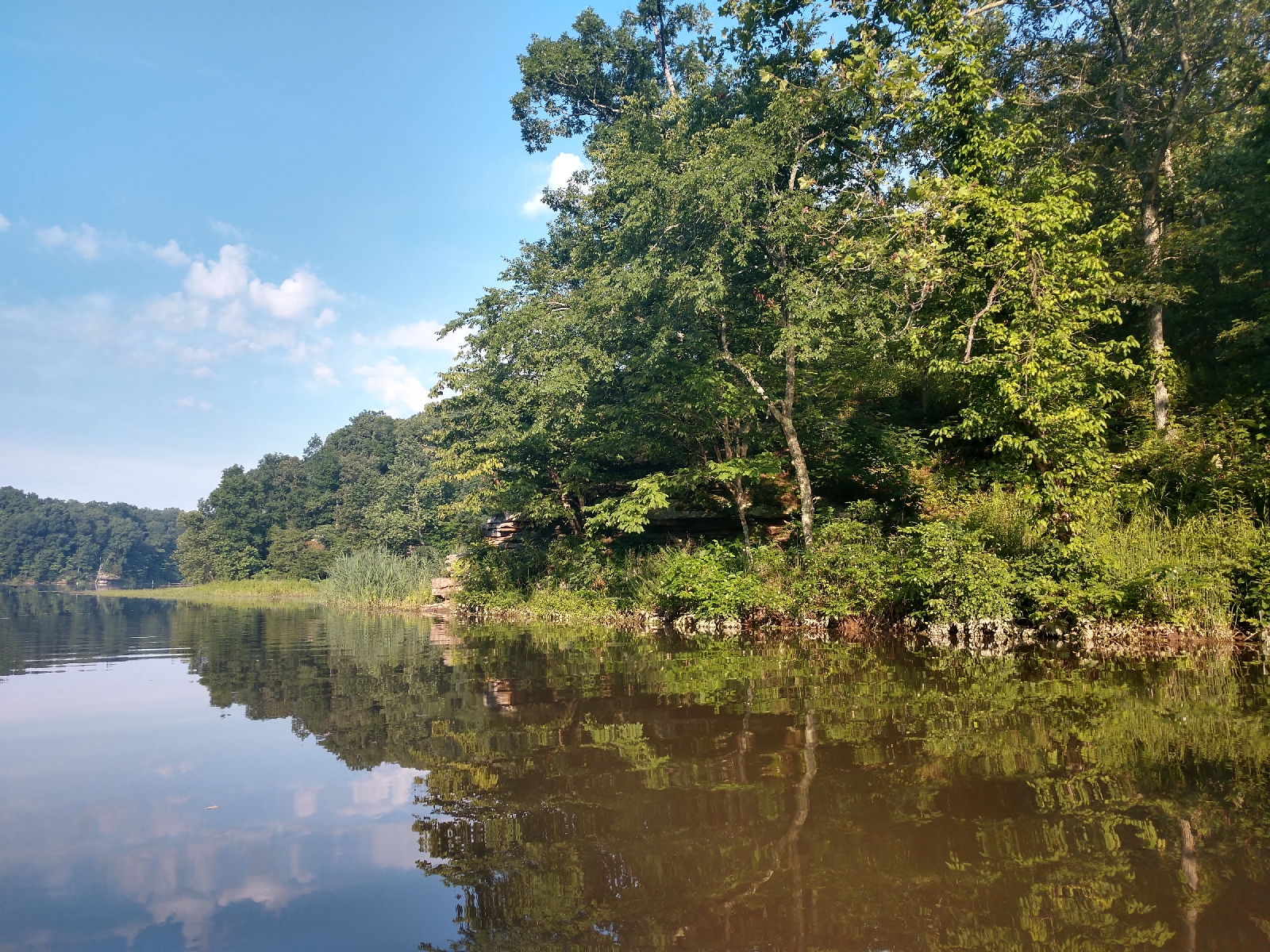
   Finally after rounding a bend and large gravel bar we spotted the obvious confluence of the rivers. The muddy color of the Current swallowing the Emerald Green of the Jack's. We paddled into the Current and in more than one way. The current was strong in the confluence and required considerable effort to paddle out of. We all struggled but managed to make the landing with great relief. 
 Two gals headed up to retrieve vehicles and when they reached a fork in the road they turned right...into a campground, not where we parked. One soon quickly returned with the report of our vehicles not being there, some confusion set in. I mentioned passing a campground on our way in, asked if there was it was possible to go left at the fork and was told yes but with a disheartened look that said energy levels were lacking to make the effort. I couldn't say anything, I felt it myself, 18 miles we paddled, landing around 11:30am after another 4 hours on the river, 11 hours over two days. Luckily the other gal that had gone to find our vehicles had found some help and a ride to the vehicles to after which on the ride out I felt ridiculous about. They were literally .25 miles from where we landed, 300-400 yards from the fork in the road but at the same time I didn't care. I was just grateful to be back to my vehicle, able climb in, and crank the air conditioning as we navigated our way to a hot meal and a cold drink. 


Monday, July 6, 2020

Devil's Kitchen Lake

Darkness still claimed the sky, a faint ever growing light bleeding into the clouds casting a pink hue across the horizon. 
Humidity so thick in the air it clung to your skin as a light fog lifted and promised a sweltering Independence Day. 
   Sunrise as we made our way to our next    adventure

A couple hours navigating highways and interstates and we were launching into Devil's Kitchen Lake at the Kayak/Canoe Launch off Tacoma Lake Road. One look at the ramp, steep, edged with slick mud and deep water promised an interesting entry/launch of our kayaks for us. We are more used to a gentle slope into the water, but adventure is an adventure so with all the grace of a fish out of water we launched into the channel off the Eastern Arm of Devil's Kitchen. 

  Rocks line the banks of the channel at launch

Things of visual interest and wildlife sightings are what make the best paddle trips for us and this little channel of Devil's Kitchen Lake quickly offered both. The opposing bank from launch was lined with exposed rock covered in sporadic rich green moss, complete with twisted and gnarled roots of trees clinging to them. 

We paddled left first, intrigued by the exposed rocks, the sun glaring in our eyes as it began to peak through the trees. 
                         Morning view

More moss covered rocks lined the channel as we approached a bridge. The air was less sultry here and paddling through the still water took little effort but soon a log jam prevented us from further exploring the channel. 

   Exposed rock shelf along channel bank

                 Bridge over channel

Making our way past the launch we continued toward the waters Eastern Arm, rocks dotting the landscape of steep hills and high banks. Rounding a slight bend in the channel we were greeted with a large exposed rock bluff edging the bank of the channel. 
Ripples in the surface echoing the flow of water told the tale of nature's wear on its surface. Light reflected from the water below, bouncing and shining from its underbelly. 
                       Large rock bluff

Continuing on the banks we lined with reeds occasionally broken by slides into the water, made by either beaver or otter. We surmised otter as there was no visible sign of beaver in the area. Rocks jutted out here and there from the tall hills surrounding us and soon an otter was spotted in the water 30 yards ahead of us. Oblivious to our presence for a moment it swam about before spotting us and quickly ducking below the surface. 
       Exposed rocks near otter sighting

Reeds and river cane still lined the banks and at the base of a steep hill appeared to be a beaver dam though still no visible sign of their presence. Paddling on just a few minutes later a beaver entered the water and swam about the water for several minutes before becoming aware of us and plunging below the surface with a loud splash. 
    A small brown head can be seen leaving a wake in the right hand side of the picture, just above the dark logs 

The channel opened up as it began to meet the Eastern Arm and we bore left wanting to stay in this no gas powered motor area of the lake. 

Large hills peaked around us and tall dead trees jutted from the still water. Here we first encountered stumps, just under the waters surface or barley breaching. Initially easy to spot and avoid but later as the sun rose in the sky it became more difficult. A total of four different occasions between the two of us we became hung up, each having to assist the other to get clear at least once. This process became bothersome after some time and a long paddle on hot day. 
         Dead tree jutting from the water

Another matter of note was the lack of bird life at Devil's Kitchen. A Great Blue Heron, a single Lake Loon, a few swallows, and a sparrow were the only birds of note besides crows raising a rucus in the nearby forest. I found it surprising given the schools of small fish we encountered so near the surface they created large swirls on the placid water. 

All and all it was a quiet relaxing paddle, best part being an absence of people and boat traffic. I can not wait to explore more of Southern Illinois lakes and waterways. 


Sunday, June 21, 2020

Reelfoot's Glory Hole Canoe Trail

      Faint light began to spread across the early morning sky before the Sun finally broke the horizon. The steady hum of the dual exhaust on my husband's truck in my ear as we navigated our way Southeast. 

                Sunrise in the sideview

     Less than two hours after daybreak we launched our kayaks into Reelfoot Lake. A flock of white cranes and a wayward racoon greeting us as we made our way down Grassy Island and the start of the Glory Hole Canoe Trail. 

    Canal at start of Glory Hole Canoe Trail

    Summer was upon us as was the usual heat and humidity of the South. We hoped to beat the worst of it by launching early and it seemed the weather would accommodate us. 

     A cool breeze greeted us as wet set off, following channel first hemmed by reeds and Lilly pads with gnarly Cypresses jutting from the water. The sounds of frogs calling for possible mates and a Bluebird nestled in the branches sang to us. 

    Sun peeking through the Cypress trees

   The breeze brought with it the smell of fresh clean linens, so crisp and fresh as only Nature can smell. We meandered down the canal, dodging off track to explore a rather impressive knook of Cypress. Duckweed floated upon the surface but with it pink flower petals from bushes that clung to the knobby knees of the Cypress and the Sun shine down through their branches casting shadows about. 

           Flower petals atop duckweed

  Calm and quiet enough to hear the buzz of the bees feeding on the pollen of the pink flowery bushes. We continued on staying left as the channel opened up into Buzzard Slough. An otter quickly dropped off the base of Cypress and slid into the dark waters. Further down a Bald Eagle flew from his perch and followed the channel until he was out of sight. 

       Marker on Glory Hole Canoe Trail

  The waters quickly became soupy with duckweed, making paddling arduous. The decision was made to turn around and head left further down into Buzzard Slough. Ducking through Cypress we headed South, actually choosing to paddle between the gnalred bases of Cypress rather than the open waters of the channel. 

  Paddling among the weathered and flared bases of the Cypress we marveled at their sizes and shapes. The gaping holes wore into their bases, the flowering bushes that seemed to filter tiny bits of soil from the water with their roots which formed micro biotic islands nestled in the bases and knees of each Cypress present. The bark of some twisted and wrapped around the trunks while others ran vertically and even a few Cypress that shot out horizontally along the waters surface. 

                Dead Twisted Cypress

  A fishing boat began to make its way by us in the channel, I expected some waves from its wake given the short distance between us. I was surprised to find very small waves had actually made their way to us, so small they were of little notice. 

  We continued on further, paddling between the Cypress before crossing the channel and turning back North. Here the bases of the Cypress seemed larger with less bursh and bush about their bases. The other unfortunate part to this side of the channel at this point in the morning was the lack of shade. We quickly crossed the channel again seeking the long shadows of the Cypress for solace from the rising Sun. 

              Finding the shadier spots

   The Sun began to creep toward it's crest in the sky and the humidity began to cling to our skin. We paddled on, navigating our way back into the narrow channel between the Lilly pads and reeds with our arms aching and the breeze had dropping too the occasional status. 

  We made our way back to the foot of the small boat ramp we had launched from. Our arms ached, sweat glistened on our skin, and our love and respect of Reelfoot had only intensified. 

   I am enchanted by this little quake lake so full of life, decay, and beauty all mixed into it's shallow waters. I'm curious as to how it will marvel me upon my next trip, for it never fails to do so. 


Friday, June 19, 2020

It's been awhile.....

   It's been awhile, about 3 years actually. I've thought about picking this blog back up a hundred times and obviously I finally did. 

    I typically kept this blog restricted to an educational resource based style for those looking to adventure off the beaten path. Today I'm going to take us in a bit of a different direction. 

   I've done a lot in the time I've been gone and traveled many miles in more than one way. One of the places I found myself..... was lost. 

   I became an Ambassador to an outdoor blog for women, rose in the ranks to run day to day operations, and while it was an amazing adventure, road tripping across the country, making new life long friends, working with/meeting amazing women, and enjoying new adventures I thought I'd never get too, it was also when I lost myself. 

   There was always major pressure to be nice, incessant whining, contradictory actions regarding operations, constant bombardment of notications, people being critical of your work both behind the scenes and on the front lines. It was trying to say the least, despite it all, I stuck it out because I believed in what the blog was about. 
 
   You're next question I'm sure, what happened? Well making to the top isn't all it's cracked up to be for the aforementioned reasons, but also being at the top affords you a different perspective on many things. Sentiments of care seemed perfunctory, alterior motives became clear, and an obvious lack of appreciation of more than just myself was revealed to a level of actual disrespect. All of this is without mention of the lack of leadership and guidance by the founder, in fact, an almost complete absenteeism. The cracks that seemed small at ground level were now from the top, huge gaping Canyons that traced the entire landscape.

    Fractured was my reality, broken was my spirit and pure disappointment rattled my core. Despite it all, I respectfully resigned my position and held my head high because I knew I had done my best, given my all and done it all while being genuine. 

    Resignation isn't in me, I'm a fighter through and through but you also have to be able to accept certain things and certain people as they are. There is no change for them, only years of wind and water could move their hearts and my waters just don't run deep enough at my age for things that had become so blatantly disingenuous. 

  Do I regret it? Absolutely not, it was one amazing adventure where I was apart of something I never imagined I could be. I made amazing friends, worked with such capable strong women but it also helped me realize I didn't need to be apart of it to keep doing what I do and that's inspiring others to have their own adventures. 

  leading a group paddle trip with beginners

  I kept in touch with many of my fellow Ambassadors/co-workers as well, even meeting up to adventure with them or act as guide for them after my departure and had no harsh feelings for their continued involvement. It took a little awhile but almost every single one of those also left the blog on their own accord, for their own reasons, and in their own time. That spoke volumes to me, it affirmed my thoughts and actions. 

   I've drifted now from them for sometime while rediscovering myself but that isn't quite right or moreover not where I stopped. I kept going once I found myself again and also discovered my worth. I've always lacked confidence and had low self esteem in more ways than just appearances. I realize now my worth is much much more than I ever imagined it to be, that I am in control, and I make the rules.  It's a very powerful feeling, I've spoke of something akin to it in an article I did for the major blog once, but I hadn't yet truly achieved it. I thought I had, but it took a vast amount realization, awareness and acknowledgement of conditions to unequivocally reach what was undoubtedly my worth. 

   I am more me than I ever have been and unapologetically so. Does that makes sense? I am uncensored, raw, real and an enigma all rolled in one big contradictory ball which my clumsy self will probably trip over. I value people for who they are, the beauty of their souls which is reflected in their genuineness, sense of humor, and treatment of others. I am fascinated and continually enamored by people while desperately needing to depart their company to seek solace in the wilds of nature. 

   Reflection of trees on Cumberland River

  I wonder now how to reconnect with those I drifted from. I also wonder how they'd react to the new me. There are some I doubt it would shock very much and those are the ones I want at my side for they saw my worth from the onset. 


Wednesday, March 22, 2017

Piney Creek Ravine State Natural Area

Piney Creek Ravine


So the other weekend we decided we were ready for yet another adventure after taking a little hiatus over the holidays. Our destination was less than 3 hours from home one way and with several stops planned we opted to find overnight lodging. Who wants to drive that far all in one day after hiking several miles? Not us, anyways.
The morning started with what is typical for us.....trouble. My husbands newer pair of jeans ripped out before we could even pull out of the drive. Nothing new, just a hiccup, head down and plow ahead, right? We'll this time we should have taken it as a sign but hindsight is twenty-twenty.
The drive up to Piney Creek Ravine was uneventful and we were thankful I had opted for a more scenic route along the Great River Road. Bald Eagles, Snow Geese, Canadian Geese and many more types of birds thrive in this flood plain that abuts the rocky ridges of the Southern Illinois Ozarks.
The weather was cold but we had layered up in preparation so when we arrived at the trail head I only needed to grab my pack. I almost forgot the trail map but my husband stated he got one off the trail head kiosk so I locked the car and we headed off.


To access Piney Creek Ravine you must stroll a mowed path between fields before reaching the actual reserve and trail head. Turns out it was a deceitful entrance to a RUGGED trail. The sun was shining but the wind blew a cold breeze against us, making me thankful I had layered up and grabbed my new crocheted beanie I had just gotten for Christmas.
Upon reaching the official trail head the mowed path disappeared beyond the preserve signage and a worn dirt path lead us into the forest. Downward into the ravine we went, spying frost flowers along the way, an unusual sight so late in Winter. We marveled at the rock bluffs beside us and soon found ourselves having to ford what I assume was Piney Creek. Our pooch Kennedy has never been fond of water and today was no exception. He refused to follow my husbands footsteps along the stepping stones and was soon in the creek. I used my Kelty trekking pole for balance and managed to keep myself from getting wet.


Soon we found ourselves at a crossroads of sorts in the trail. I remembered during my research that you had to take a dead end side trail to see pictographs and petroglyphs left by Native Americans on the bluffs but I wasn't sure if this was the trail. Signage seemed to indicate we where in the right area so I asked my husband for the trail map. I unfolded the little pamphlet to find the trail map inside only to discover it was simply an outline of the preserve showing the location of the trail head and no map of the actual trail itself.


My husband apologized profusely for the error but what was done, was done. There was nothing we could now but push onward, opting to focus on the main trail. We followed the well worn path around boulders, downed trees and eventually to the top of the bluff overlooking Piney Creek Ravine. We took a rest atop trees that fallen across the trail. My legs were cramping badly, I hadn't had my medical massage in a couple months and I was feeling it.


Hydrated and my cramps having relented we pressed onward again soon hearing the sound of a waterfall. We studied the creek below between the bare branches of the forest and found a waterfall flowing just upstream some way through undulating terrain. Taking a moment to enjoy it's beauty before we followed the trail down a steep slope that turned left into more steep slopping terrain.
The bottom of this large hill was again what I assume was Piney Creek and of course the trail crossed it once more. This time, fortunately, the rocks were actually large flat boulders and the water level was low enough that with a little jump across the cracks in the stones one could cross without getting wet. We entered the creek bed and began to explore a little when we caught sound of another couple hiking the trail in our direction. I paid little attention as I snapped a few photos before rejoining my crew on the upper boulder in the creek bed. It was at this point I realized that I had lost my new beanie!!! I had haphazardly shoved it into the front pocket on my hoodie and now it was gone, lost somewhere along the trail.
I knew I had it the last rest stop we'd taken so I immediately began bee lining it back up the steep slope as fast as my overweight butt could manage. I stormed the first hill like Grant leading a charge during the Civil War, my eyes scanning the ground along the way, but quickly ran out of steam and at the turn in the trail I had to stop for a minute to catch my breath. Huff, puff, huff, puff, sweat...where the hell is that breeze? Huff, puff, huff, puff....please let me find my beanie.......and onward we go. I managed to make halfway the next portion of the trail before I had to stop again. Hills are the devil, I thought to myself as my lungs sucked in air one deep breath after another. I started out yet again and spied my beanie laying beside the trail on a bed of moss. Exactly where we had stopped to admire the waterfall.
I picked it up, knocked the leaf litter off and did an about face, heading back down the devil hill. I made it back to the turn fairly easily and decided to rest a moment before tackling the next section. From this vantage point I could see my husband seated on the boulder in the creek and Kennedy looking up the hill at me, I waived my beanie at them, letting my husband know I had found it. I also spied the other couple a little further down the creek exploring it's nooks and crannies.
My face was red like a little kid from the effort, I was sweating, my thighs hurt just above my knees from bracing my weight on the downhill potions of the trail. The weather was still cold but warmer than we had started and now above freezing causing the ground to thaw. Feeling weary but ready enough I began the final descent of the devil hill. A few paces into my descent I planted my right foot and began to feel it slip out from under me. I tried to steady myself with my trekking pole but there was no stopping my foot from carrying my leg away from me and down I went.
I landed on the right side of my back, feeling a rock jab in my side just above my hip bone. I looked to my right only to see the other couple staring back at me like I was a Sasquatch throwing rocks at them. I looked down the trail to the creek bed where my husband looked back at me shaking his head and if a dog can show concern Kennedy sure appeared to be doing so.
For a minute or two I just laid there on the trail like a slug in winter. I sat up and studied the ground under my foot, finding a loose rock that had been hidden under the leaf litter. I kicked it off the trail like a pouting child then picked myself up off the ground. I started descending the devil hill again, the other couple beginning their accent, I assume now that the trail was clear for them to proceed. We politely greeted each other in passing them asking how I was doing. “Great, if I hadn't lost my beanie.” I replied making no mention of the obvious fall I had taken.
I rejoined my crew in the creek bed and took a seat in a notch on the boulder. The cold of the stone felt good as it penetrated my layers of clothes, after a quick rest and a selfie or two we started out on the trail again. The outside portion of my right foot began to hurt and we soon came to another trail intersection. Not having a map to check which direction we needed to go, I pulled out my cellphone and referenced the GPS tracking app I had initiated near the beginning of our hike. Thank god I had thought to do so as there had been no mention of any other off shoots along the trail so a 2nd intersection came as a complete surprise.


Looking at the GPS app I was able to determine we needed to continue on the trail to our right in order to loop back to the trail head. I could only guess the other trail went to the waterfall we had spied earlier and on a better day I would have been keen to explore it but that wasn't this day.
We followed the trail on a ridge overlooking Piney Creek from the opposite vantage point. I continued to check the GPS app on my phone to ensure we were headed the right direction and was grateful when we finally completed the loop portion of the trail. I tucked my phone back into my pocket and focused on getting myself out of the woods despite the ever increasing pain in my foot.
This wasn't my neuropathy acting up again, no burning, no tingling and no tiny needles stabbing me meant this was something else. The pain was not only in a different location but was a different nature all together. I protested to my husband about the pace he was setting or letting Kennedy set. Truth be told I would have much rather kept right on pace, out of that ravine but my foot was killing me. As we neared the trail head I questioned if I could keep going, the pain was becoming that bad.
I hauled myself up, out of the forest, off the trail on onto the mowed path. I was beyond thankful for relatively flat even ground with no boulders or trees to climb over. The pain persisted even once at the car. I spent twenty minutes trying to work what felt like a foot cramp out before climbing behind the wheel where I drove us to our next stop.
Historic Fort Kaskaskia on the banks of the Mississippi River where I hoped we could have our picnic lunch and get my shoe off for a few minutes. Once there we started to stroll about the grounds when it became apparent I wasn't going to be able to do much or anything more for that matter. The pain in my foot was so severe I couldn't bear weight on my heel and was forced to only use my tip toes on my right foot. I returned to the car and attempted to massage out some pain while my husband walked the dog.


There were no picnic tables at which to sit and honestly I wouldn't have done so, had there been. The breeze blowing up off the river was as cold as ice and no amount of sun that day could warm it. We dined in the car instead before setting out for the town of Kaskaskia, IL which is West of the Mississippi. My goal had been to see the Liberty Bell of the West with it's Revolutionary War heritage but again once out of the car I was relegated to hobbling and had no patience to wait for a care taker to unlock the building where the bell was housed.
We made our way to the hotel where a hot shower was more than welcomed as well as a good nights rest before setting out to Trail of Tears State Park but my foot had other plans. The pain was so great I couldn't sleep, my husband and dog were curled up comfortably sleeping away while I would lay down for 5 minutes before the pain would force me to sit up and massage my foot, time and time again. I was so tired at one point I almost fell asleep sitting up!
This was my routine until around 2 a.m when I finally relented to hobble back to the bathroom and let hot water run over my foot. It was enough relief from the pain that I was able to finally get a few hours rest before waking again. When I awoke it was daylight, me and my husband both agreed it was time to hit the road and head straight home which is exactly what we did.
On Monday with no improvement in my foot I took myself to the doctor, an examine, some X-Rays, and I sit here and type this 11 days later in a walking cast. Soft tissue damage was the verdict, no breaks or fractures. I'm hoping soon I can remove my walking cast and return to a normal gait but it maybe a few more weeks before I'm actually able to hit the trail again. Oh well, gives me plenty of time to research the next adventure!!
If you fall off the horse, you have to get right back on.

Adventure Awaits!

Friday, November 11, 2016

The Natchez Trace Parkway-Tennessee

Sign for the Old Trace Walk along the Natchez Trace

The Natchez Trace Parkway

     Ready for yet another adventure my husband, Donald, and I scoured Google Maps looking for the perfect place. Just Southeast of Nashville, Tennessee Donald found David Crockett State Park and as it turns out, if routed correctly we could travel part of The Natchez Trace Parkway. Alright a great scenic drive on our way down to hike in David Crockett I thought. 
   Honestly my back and hips had been killing me lately, I wasn't sure if I was up for several hours in the car, let alone hiking. Lots of icing and hot baths over several days and I finally felt like I could manage, although how much remained to be seen. I was feeling reluctant to make the trip but had already committed and I'm a woman of my word, come hell or high water. 
   Feeling better I finally started researching The Natchez Trace and stumble upon an amazing site, Natchez Trace Travel. Clicking around through the site one can plan their entire trip, from traveling the entire 444 miles from Natchez, Mississippi to Nashville, Tennessee or by traveling sections at a time which we did. An interactive map highlights points of interests and "hot spots" or places of high interest along the way. History and nature collide on this National Scenic Byway which is maintained by the National Park System. 
    I was finally excited about our trip and quickly began using the interactive map on Natchez Trace Travel to learn about the history and discern which stops were in the portion we were traveling as well as which stops we wanted to make. Spreadsheet, I had to have a spreadsheet! There were so many and all carefully detailed, even the mile marker noted! 
    American History has always been one of my favorite subjects, since grade school I devoured anything under the subject and my interest has only grown with my age. Nature, of course, has always been a big part of my life, ever growing from family requirement to an interest and place of solace to a passion and devotion. Being able to combine the two is an awesome adventure to me. 
    Early, I mean EARLY, on a Saturday morning we headed South leaving the state of Kentucky and making our way down to Tennessee. It was dark; so dark there was no horizon, it was cold, and everyone was tired except for Kennedy, our Jack Russell Terrier mix. Donald and I both couldn't wait for the Sun to come up so we could see something other than what the car headlights would allow. 
   When the Sun finally did come up it was blinding as we traveled toward it and Nashville but I at least felt like I wasn't traveling on the Moon any longer. The terrain was much hillier, almost mountainous as we closed in our target. We picked up The Natchez Trace Parkway near an area called Kinderhook, south of Leiper's Fork  and around mile post 410. The Natchez Trace actually starts in Natchez, Mississippi so the miles go up as you head toward Nashville or down for vice versa. 
  The first stop on our list was Water Valley Overlook, a scenic overlook with a picnic area. We reach our target around 9 a.m., there was still a heavy chill in the air, and patchy fog slowly lifting from the low lying areas. Foliage forecast had predicated that we would be arriving during peak colors for the northern section.

View from Water Valley Overlook

  We couldn't have scripted better weather or colors for our day on The Natchez Trace. The Sun was shining, there was a bit of a cool breeze, and the colors were magnificent. Water Valley Overlook was stunning, the hills of the countryside laid out before us, green and brown fields border with rows of trees made a patchwork of the valley floor. Ponds with wisps of fog rising from their waters sat nestled among the steep forested hillsides of greens, reds, oranges, and rust colored hues. Thick patches of fog hovered above the trees in the recesses of the hilly terrain. Farmhouses, barns, and livestock completed the picturesque scene. 
  After stretching our legs a bit and taking the beauty of the first stop we made our way down to Baker's Bluff Overlook. Another stunning scene as described above was laid before our eyes. 

View from Baker's Bluff Overlook
    Large white Cows bellowed below us, their calls echoing up to us off the hills. We meandered around and found a trail that lead to Jackson Falls which was our next stop on the list 1/3 of a mile away. Donald prodded me to take the trail and after snapping a few pics I joined him near the trail head. A sign immediately warned "Steep Incline", all one simply had to do was look past the sign to see you were literally going to be face to face with the ground as you ascended. Nope, no thank you. I quickly shook my head and turned around. I don't mind hiking in the least bit but when I'm going have to claw my way up, you can forget it. I advised Donald we could just drive, if I remembered correctly and cut out a large portion of the death by mountain style hike. He and Kennedy rejoined me at the car and we drove to Jackson Falls.
   Jackson Falls provided a bit of an overlook, most of the view being blocked by trees and foliage. There was another picnic area and another trail head down to Jackson Falls as I had suspected. We trekked our way down a concrete sidewalk along the steep hillside. Navigating over a small wash with a wooden bridge and further down too the foot of Jackson Falls. Unfortunately much of Tennessee is experiencing the same drought conditions that Kentucky is and there was very little water flowing over the falls.

Jackson Falls
   What water was flowing echoed off the high stone bluffs that surrounded us, green moss still clung to the rocks along the creek, the leaves were a kaleidoscope of colors against the sky and Earth. We milled about, I taking pictures, Donald and Kennedy exploring. A bench sat just off the creek, facing the falls so we took advantage and soaked up the sounds of the forest and the trickling water, all deliciously devoid of human noises.

View from the bench at Jackson Falls
   The bad part about descending is usually you must ascend at sometime or another. For us it was obvious as we trekked down that would be our path back up and I knew it was going to suck. Despite knowing that I had gone down, now I had to go up. I have been working on my inclines, trying to keep my posture correct while traversing them and thereby hopefully reducing any low back pain. All in all, it wasn't too horrible, a few craps, some huffing and puffing, and I was back at the car.

The not so steep section down to Jackson Falls
    Next stop was one of my favorites, Old Trace Walk, where you can actually walk a portion of the original Trace. The Old Natchez Trace dates back to the 1700's when sections were animal or Indian trails.


Sign at the trail head

     Here we strolled down the sunken path worn by many before us hundreds of years before. The Autumn colors abounded as the Sun peered through the forest canopy at us. Leaves crunched under our feet as we retraced the steps of so many along The Natchez Trace. On our way back we came to a spot where the birds were chirping loudly and squirrels were milling about the branches. We stopped a moment, took a seat upon a downed tree and just took in the forests sounds. Suddenly a Chipmunk jumped out just 20 feet down the path and darted across the forest floor. We watched for a few minutes as he darted in and out of the downed leaves on the forest floor before taking our leave.

Section of Old Trace Walk
     A large expanse of undulating forest spread out before us at Swan Overlook, dotted with the water tower for the town of Hohenwald. Hills, splashed with the varying colors of Autumn, that rolled till they smacked right up against the horizon.
Swan Overlook
       Fall Hollow Falls awaited us next and I hoped it wouldn't be as dry as Jackson Falls had been, nor as steep. We pulled into the parking area and headed down a dirt path,  that lead to a wooden bridge over a small stream. The sound of the falls was apparent as we headed down the path. After crossing over the bridge the trail turned, becoming muddy at times and made it's way to a wooden observation area overlooking the falls.

Fall Hollow Falls
     We took the time to snap a few pictures before an older couple joined us. After making small talk we made our way back to our vehicles and as we began to pull out the man held up a drink, offering it to us. We politely waved off his offer, being well prepared. It can be some distance for fuel, food, water or lodging along The Natchez Trace so his offer was understandable, although not needed, but very much appreciated. It was nice to see such consideration from a complete stranger we hadn't spoken to for more than 10 minutes.
     The Natchez Trace Parkway is like any other road, requiring maintenance and upkeep. Current maintenance meant that a portion of the parkway was closed. We had hoped it had been completed prior to our arrival but we hadn't been so lucky. There was a marked detour and I did print off the map so there was no issue getting around the closure.
     Highway 20 intersects with The Natchez Trace and here you will find the death and burial site of Meriwether Lewis. A pioneer cemetery with a monument of a lone broken shaft reaching toward the sky to commemorate the historic figure. An old pioneer log cabin sits, abandoned, a shuttered site for information. More portions of the Old Trace can be walked here as well as the site of the homestead where Lewis met his demise.
 
Pioneer Cemetery
      Our next stop was Metal Ford and Buffalo River, the historical site where pioneers forded the cold waters of the Buffalo River and former home to Steele's Iron Works. A charcoal burning furnace was used on site to manufacture pig iron, though there are no remnants. We strolled the little trail that followed the shore of the Buffalo River, it's babble ever present. The little trail eventually turned and went down into a dry channel once used to funnel water off the river for the furnace. The channel walls were only 8 to 10' in height and it's floor lined with dry leaves of the season's colors. We followed the path back to it's start and explored a little more before taking our leave.

Buffalo River

   The final item on our list was Old Trace Drive, where one can drive a 2.5 mile portion of the original route. I was a little nervous about taking my Malibu down this drive but after talking to a few others who had driven it on motorcycles I had little worry. It wound it's way through the woods, brilliant from Autumn's brush. There were several spots providing scenic views to the surrounding hills full of yet more Fall splendor. It's certainly a must if you ever find yourself along the Natchez Trace.

Old Trace Drive

   Back out on The Natchez Trace the remaining five miles we soaked in the beauty every second we could. Donald nor I wanted to leave it behind us but a new adventure laid ahead in David Crockett State Park.  We arrived to find a 5K race going on and people everywhere. Navigating back through the park was difficult, with runners, hikers and other traffic dotting the way like an obstacle course. It was quickly decided to abandon our original plan to hike to the falls and instead we drove up and parked nearby. Parking wasn't easy either, the circular lot was full of cars and people. I managed to find an empty slot and parked.
  It was a simple stroll to David Crockett Falls, several people were playing and wading in the stream. I hurried down to the shoreline, snapped several pictures and then dashed back to the car eager to get away from the onslaught of humans after a tranquil morning of virtual solitude.

Crockett Falls
    We had decided to take advantage of the the pet friendly dining area at the restaurant in the park, Crockett's Mill. Donald and Kennedy took a seat in the outdoor dining area while I went and let the staff know our wishes. We were quickly accommodated with silverware and menus being brought out to our table, the waitress even served Kennedy a bowl of fresh water. The food was okay, nothing to write home about, but was nice to see a sit down restaurant with a pet friendly option.
   It was time to start making our way back toward the hotel we had reserved a room at. I had chosen a different route to return along, Highway 13. As it turns out, it was a Scenic byway through mountainous terrain with winding curves and steep hills. It was a beautiful drive through the scenic Tennessee countryside.
  By the time we made it to our hotel we had been on and off the road for 10 hours and I couldn't tell you how many miles we had logged. Everyone was definitely ready to be out of the car for more than a few minutes at time. Our hiking plans for the day had been thwarted so we sat down and did a little more research for where we could hike that was en-route home.
  We quickly found Big Sandy Wildlife Refuge, it was still open for another couple weeks and had a trail that interested us. Plans were made to be up early again the following morning and with Daylight Savings Time ending, we got plenty of rest.
   Another couple hours of driving had us landing in the Big Sandy Refuge where we made use of Bennett's Observation deck on our way back towards the trail head. Ducks, geese and even American Pelicans could be spied along the shores of the Tennessee River.
   Gingerly driving down dusty gravel roads we pulled into the trail head parking only to find that the trail was closed for hunting season. Disappointing to say the least, we had saw no notice on the website but definitely didn't want to be accidentally shot by someone game hunting. I turned the car around and we drove the remaining distance back home.

Bennett's Observation Deck
   I fell in love with the Natchez Trace while there and despite any other disappointments in our adventure it was more than worthwhile to explore such a gem in the heart of Tennessee. Next time I travel the Parkway I hope to be completing the remaining miles in Alabama and Mississippi.
  It's important not to let little setbacks and disappointments overshadow something that was so spectacular. In today's world it's easier to look towards the negatives but I choose to dwell in the light of the positives and revel in my experiences, good or bad.

Adventure Awaits!