|
| Trade water River |
Another hidden gem of the Pennyrile Region of Kentucky is Dawson Springs, KY and their 7 mile paddle trail down the Tradewater River. Don't own your own canoe or kayak? Rent one from Hank over at
Located right on the river in Dawson Springs off Highway 109. Hank has very reasonable rates and will even shuttle an additional boat not rented from him at no charge.
We found the paddle trail while searching for hiking trails in the
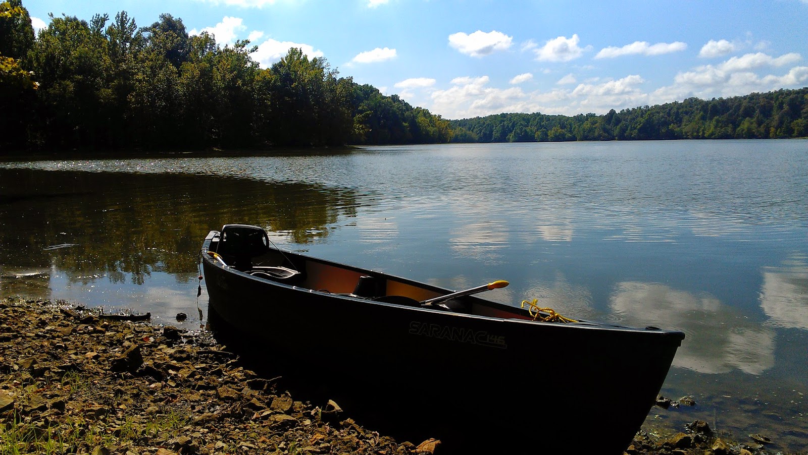
and instantly began planning a trip. We planned for a couple weeks with our best friend and his girlfriend to paddle all 7 miles of the trail and finally on a gorgeous Saturday morning we loaded up in our Black Chevy extended cab with our Old Town Sarnac XL 146 and headed east of the lakes region to Dawson Springs.
We arrived to find Hank at Tradewater Canoe and Kayak prepping for a busy day despite the chilly start. Hank advised me the map I had printed off only covered the section of the river through Dawson Springs and not the upper portion and actual start of the trail. Once our friend rented a 14ft Sun Dolphin Canoe from Hank we helped him load the rental and transferred our canoe to the trailer also and headed to McKinney road to catch the start of the paddle trail.
Our friend, Nick, owns a kayak, but it's for a single person and his girlfriend, Jackie, had never been paddling. Nick decided to rent a canoe from Hank vs. a kayak due to Jackie's novice level. We gave her a few pointers that morning and a reminder her of them again just as we set off.
We launched the canoes and set off for miles of sernre country and quiet.
The upper Tradewater with it's high banks didn't allow for much scenery but the wild flowers growing along the edge of the banks sporadically, mixed with knarled roots of old growth trees, and the occasional rock wall or outcropping gave enough interest to make this section worthy of the trip. We navigated past log jams from recent rains that had clearly raised the water level of the Tradewater for a time, but being a natural river it had abated to normal flow before our trip.
Paddling our way past feeder creeks we found the only rapids of the Tradewater which could hardly be called such. A small dam just below the surface created this little section of rapids and provided a break up of the slow current.
Rapids of the Tradewater Video
Once we had paddled an hour or so we came to the first big bluff along the river, Dripping Rock. The massive rock outcropping hung over the Tradewater with ground water dripping from it's high edge.
Due to the recent high water there was a lot of debris in this section but it was navigatabled, after passing Dripping Rock and a small island we looked to our left and spied a Doe standing along the bank.
We continued on, paddling past budding leaves, the ever growing green of Spring, and under Blue skies only occasionally dotted with a white cloud or two. Happening upon what appeared to be a rather rocky bank and beyond ready to stretch our legs and get off our bottoms, we banked the canoes only to find the rock an illusion of sturdy ground. Our feet sunk several inches into the muddy silt with every step but we paid little mind, desperate to be out of the canoes. After milling about for 15 minutes or so we boarded our canoes and headed down river again.
We arrived to find Hank at Tradewater Canoe and Kayak prepping for a busy day despite the chilly start. Hank advised me the map I had printed off only covered the section of the river through Dawson Springs and not the upper portion and actual start of the trail. Once our friend rented a 14ft Sun Dolphin Canoe from Hank we helped him load the rental and transferred our canoe to the trailer also and headed to McKinney road to catch the start of the paddle trail.
Our friend, Nick, owns a kayak, but it's for a single person and his girlfriend, Jackie, had never been paddling. Nick decided to rent a canoe from Hank vs. a kayak due to Jackie's novice level. We gave her a few pointers that morning and a reminder her of them again just as we set off.
We launched the canoes and set off for miles of sernre country and quiet.
 |
| High banks of the upper Tradewater |
Paddling our way past feeder creeks we found the only rapids of the Tradewater which could hardly be called such. A small dam just below the surface created this little section of rapids and provided a break up of the slow current.
Rapids of the Tradewater Video
Once we had paddled an hour or so we came to the first big bluff along the river, Dripping Rock. The massive rock outcropping hung over the Tradewater with ground water dripping from it's high edge.
 |
| Dripping Rock |
Due to the recent high water there was a lot of debris in this section but it was navigatabled, after passing Dripping Rock and a small island we looked to our left and spied a Doe standing along the bank.
We continued on, paddling past budding leaves, the ever growing green of Spring, and under Blue skies only occasionally dotted with a white cloud or two. Happening upon what appeared to be a rather rocky bank and beyond ready to stretch our legs and get off our bottoms, we banked the canoes only to find the rock an illusion of sturdy ground. Our feet sunk several inches into the muddy silt with every step but we paid little mind, desperate to be out of the canoes. After milling about for 15 minutes or so we boarded our canoes and headed down river again.
The banks became less steep in this section and afforded views of pastures mixed with more rock outcroppings and the occasional high bluff.
Thankfully Nick brought along lunch cakes as we had left our cooler with bread, lunch meat, chips, etc. back at the truck and it was taking us longer than we had expected to get back to Tradewater Canoe and Kayaks where we had left the truck.
 |
| Our friends paddle past Far Bluff |
Suddenly a Blue Kayak entered the water at the bridge, followed by two more and finally a fourth. By the time we reached the bridge which now Hank stood on, the Blue Kayaks had paddle on down river. We made our way to the foot of the stairs and Hank greeted us. I popped out of our canoe, ran up to the truck and grabbed the cooler of food. Once I was again seated and had set a pick up time with Hank at the last take out before the dam, we continued on.
I was starving at this point with little in my belly, I made sandwiches for each of us with the cooler positioned between my calves in the bow of the canoe and used my thigh as a table to assemble the sandwiches. We got the canoes close enough I could pass off a couple sandwiches to our friends as we paddled on and then another sandwhich I passed back to my husband before finally making one for myself.
 |
| Highwya 109 bridge over Tradewater |
By the time we reach the bridge that carries Highway 109 across the river we were all filling our bellies and leisurely making our way down river. We had been on the river for 3.5 hours at this point, the sun had gotten high in the sky and the chill was completely gone from the air, the day warming into the mid 70's.
The banks of the Tradweater remained less steep and the scenic views continued. Now recharged and almost finished we made our way past Ghost Sign Cliff to Devil's Dining Table where the river opened up a bit, staying right we paddled past a family fishing and lounging upon the banks. On occasion we would catch a glimpse of the Blue Kayaks ahead but had no desire to catch them and continued at our leisurely pace.
 |
| Ghost Sign Cliff |
 |
| Devil's Dining Table |
A field came into view on our right, a long rock bluff along its edge a couple hundred yards beyond. It ran diagonal in the field till its edge met the Tradewater. We paddled on, our arms beginning to feel the days work. I began to wonder if we would ever reach the final take out, my bottom completely numb at this point.
In my haste to finally get off the water I missed Moonshiners Bend, not realizing so till we reached Chalk Cliffs and now had the railroad bridge in sight which meant we were closing in on the finish of our trip.
 |
| Rock outcroppings along the Tradewater |
After paddling underneath the bridge the Bule Kayaks could be seen ahead as well as Hank waiting at the take out. Grateful the end was near despite the beauty of the trip I paddle harder, ready to finally be off my bottom again. The roar of the water flowing over the dam was loud and the local baseball field sat off to our left, Tradewater Pirates blazened across the grandstand.
Ashore we loaded up and headed back toward the place we started off our day, we made a quick stop to drop off the other party whom I found out to be the woman behind Kayak Kentucky on Facebook
and had the pleasure of meeting. Shara was awesome and it was nice to finally meet someone in person who shares the same passion for the outdoors and inspiring others to get outdoors and explore. You can follow Shara, Kayak Kentucky via her Facebook page or check out Explore Kentucky
And Facebook
Or even follow #ExploreKentucky
Back at Tradewater Canoe and Kayak we loaded our Old Town back into our truck and made the drive back home. Overall it was an amazing trip although an additional spot or two to get out and stretch would be an added benefit. We spent a total of 5 hours paddling all 7 miles, quite a bit longer than anticipated but well worth every second.
Go ahead and Explore Kentucky!
Ashore we loaded up and headed back toward the place we started off our day, we made a quick stop to drop off the other party whom I found out to be the woman behind Kayak Kentucky on Facebook
and had the pleasure of meeting. Shara was awesome and it was nice to finally meet someone in person who shares the same passion for the outdoors and inspiring others to get outdoors and explore. You can follow Shara, Kayak Kentucky via her Facebook page or check out Explore Kentucky
And Facebook
Or even follow #ExploreKentucky
Back at Tradewater Canoe and Kayak we loaded our Old Town back into our truck and made the drive back home. Overall it was an amazing trip although an additional spot or two to get out and stretch would be an added benefit. We spent a total of 5 hours paddling all 7 miles, quite a bit longer than anticipated but well worth every second.
Go ahead and Explore Kentucky!
Happy Facebook OOr